Cornwall · PL14
Drone services in Liskeard
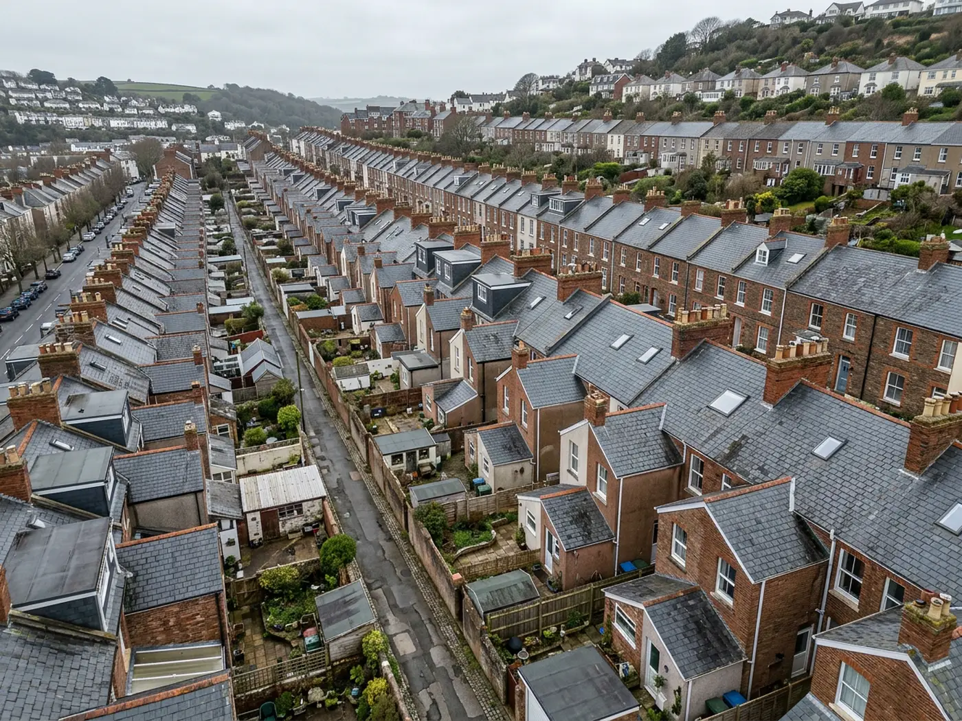
A high mining town with substantial stone buildings and terraced cottages, where above average rainfall and constant driving rain set the maintenance pace.
Built on copper and tin, roofed in Delabole
The Victorian centre was built on mining wealth and it shows: substantial stone and rendered buildings with generous roofs, Delabole and natural slate, and detailing that assumed money would be available to maintain it.
Delabole slate is excellent material and it long outlives its fixings, so the usual finding on a roof of this age is not a failed slate but a failed nail. Slates slip individually, in no obvious pattern, and each one leaves a hole.
That pattern is hard to read from the ground because a single slipped slate three courses up is almost invisible from the pavement and completely obvious from above.
Terraced miners' cottages around the town carry the same coverings on a smaller scale, with shared valleys and tightly packed access.
Rendered elevations on the larger Victorian buildings hide the state of the stone behind them, so a blown patch of render is usually a symptom of something that started a good deal earlier.
High, open and consistently wet
The town sits high between Bodmin Moor and the south coast, and rainfall is well above average with driving rain from the south-west more or less constant through the winter.
That is why slate hanging is common on exposed elevations here, and why the elevations that face the weather need looking at more often than the sheltered ones.
Prolonged wetting rather than storm damage is the main agent of decay, so surveys tend to find gradual problems: growth holding water, softened bedding, a valley that has been damp since October.
Frost matters at this height as well. Damp mortar that freezes and thaws through a winter loses its face, and a ridge that was merely tired in autumn can be properly loose by spring.
Steep valleys on the eastern side
The eastern side of the town falls into steep valleys, which puts some properties well above or below their neighbours and complicates access accordingly.
Where a property sits on a slope, the flight has to work around the gradient, because the ground above hides one elevation and the ground below exaggerates another.
It is a small technical point that makes a large difference to whether a set of photographs actually answers the question that was asked.
Access on the older streets is tight enough that a scaffold usually needs an arrangement with a neighbour, which is the ordinary practical reason photographs get chosen instead.
Land, moor edge and the wider parish
Beyond the town, the approach to Bodmin Moor and the Looe valley bring farmland, tracks and boundary work, along with agricultural buildings whose roofs nobody inspects.
Land parcels change hands regularly around here and a top-down record with access, boundaries and drainage visible is worth considerably more than a written description.
Travel from Exeter is a long run, so work in this direction is planned and usually paired with something else rather than treated as a call-out.
Barn conversions in the surrounding parishes bring the recurring junction problem: old fabric meeting new rooflights and link sections, with nearly all the water finding its way in where the two meet.
Where to go next
Booking something in Liskeard
Behind the survey
What people in Liskeard are actually buying
CAA registered operator
Operator ID and Flyer ID both held and current with the Civil Aviation Authority, which is the baseline for flying commercially in UK airspace.
A2 Certificate of Competency
The A2 CofC, which allows closer flying to buildings and to people not involved in the flight than the basic qualification does. It does not extend to flying over crowds, and nothing on this site suggests it might.
DJI Mavic 4 Pro
A 100 megapixel Hasselblad camera and 6K video. Enough resolution that one flight can produce both a photograph fit to print and a frame close enough to read a hairline crack.
DJI Mavic 2 Enterprise Advanced
A 640 by 512 radiometric thermal camera for the jobs where the answer is a temperature difference rather than something visible: trapped moisture, heat leaving a building, a warm shape on cold ground.
Insured with Coverdrone
Full commercial cover, and the certificate goes to anyone who needs to see it before a visit. Managing agents and site managers usually do, and asking is sensible rather than awkward.
A construction background
The person flying has worked in construction, which is why the report says what a defect is and where it sits rather than only that something looks wrong in a photograph.
Fixed price, agreed first
The price is set before the visit and travel inside the coverage area is part of it. No hourly creep, no mileage added afterwards.
Written report within 48 hours
Where the job needs a report, it lands within 48 hours of the flight. Photograph-only jobs have their delivery date agreed at booking instead.
Nearby
Also covered around Liskeard
- SaltashA Tamar crossing town on near-vertical waterfront streets, where the gradient makes conventional access expensive and the valley funnels the wind.
- LauncestonA hilltop former county town catching weather off two moors, where slate hanging is a structural necessity and the historic core is tightly packed.
- PlymouthA naval city of limestone ridges and post-war flat roofs, where commercial and managing agent work outweighs domestic enquiries by a wide margin.
See which one fits
Tell us what you need in Liskeard
Send the address and what is worrying you. Sam Hembury will come back with a fixed price and the next slot that suits the weather.