Drone Services Devon
Land and site surveys
Land, fields, farms and development sites, where the useful thing is a picture of the whole shape of a place rather than a close-up of one detail.
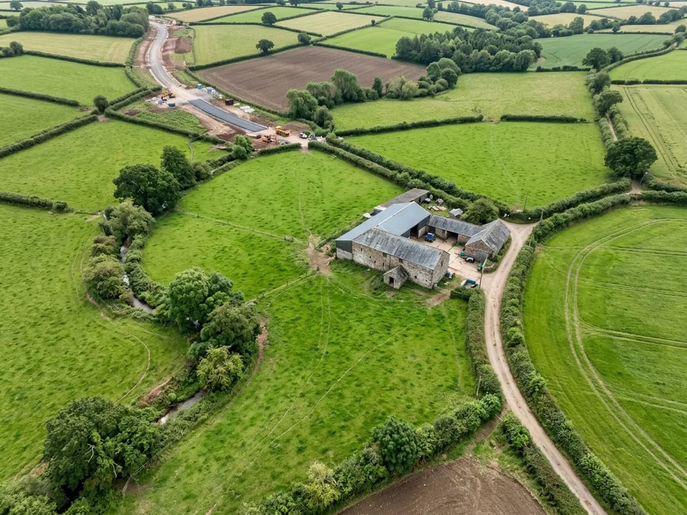
Some jobs are not about a building at all. A field with a boundary dispute, a paddock somebody wants to sell, a site part way through a build, a bank of woodland, a farm track that keeps washing out.
From a hundred metres up, a straight-down set of photographs shows the whole thing at once: what is where, how big it is relative to everything around it, where the water runs and what has changed since last time. The individual frames can also be stitched into one flat, top-down image of the site, which is the format most people mean when they say they want it mapped.
What that gives you is a picture you can measure things against and mark up, not a legal survey. Where a job needs certified levels or setting-out to a surveyor's tolerance, that is a ground survey with instruments and we will say so rather than pretend otherwise.
What is included
- A set of near-vertical photographs covering the whole area, flown to a consistent height
- A single stitched top-down image of the site where that is the useful output
- Oblique shots from each side, which is what makes levels and slopes readable
- Boundary features, access points, hardstanding, water courses and services visible on the surface
- A written report within 48 hours where the job needs one, or the images on their own where it does not
- A fixed price agreed before the visit
Progress records on a live site
The most useful version of this for builders and developers is the same flight repeated: the same height, the same pattern, the same corners of the plot, once a month or at each stage.
The value is in the comparison. A set taken before the ground was covered is worth a great deal when a question comes up about what was under it, and photographs dated on capture settle arguments that memory does not.
Farms, estates and land agents
Roof coverings on outbuildings, the state of a track, blocked ditches, standing water in the same corner every winter, fly tipping in a gateway, the extent of a hedge that has grown out. All of it reads better from above than it does from a gateway.
Devon and Cornish field boundaries in particular are hedge banks, not fences, and their real shape and condition is difficult to see from the ground and obvious from the air.
What we will not claim
No accuracy figure is quoted for these outputs, because a number like that depends on ground control, the equipment used to set it, and the checks made afterwards, and quoting one without that work behind it would be meaningless.
If your architect, engineer or planning consultant has asked for a specific tolerance or a specific file format, send us their words and we will tell you plainly whether this service meets them.
On the day
How a land and sites runs
- Step 1
Send the location and what it is for
A postcode, a what3words or a pin on a map, plus a line about why you want it: a sale, a planning application, a dispute, a record of progress.
- Step 2
Airspace and permission get checked first
Some land sits under controlled airspace or next to something that restricts flying. That is checked before a price is agreed, not on the morning.
- Step 3
The flight
Larger areas are flown in a grid at a fixed height so the frames overlap properly, which is what makes a stitched image possible. Small parcels are quicker and simpler.
- Step 4
The images come back
Full resolution files, the stitched image where one was part of the job, and a report where the job called for one.
Behind the work
Kit, cover and qualifications
CAA registered operator
Operator ID and Flyer ID both held and current with the Civil Aviation Authority, which is the baseline for flying commercially in UK airspace.
A2 Certificate of Competency
The A2 CofC, which allows closer flying to buildings and to people not involved in the flight than the basic qualification does. It does not extend to flying over crowds, and nothing on this site suggests it might.
DJI Mavic 4 Pro
A 100 megapixel Hasselblad camera and 6K video. Enough resolution that one flight can produce both a photograph fit to print and a frame close enough to read a hairline crack.
DJI Mavic 2 Enterprise Advanced
A 640 by 512 radiometric thermal camera for the jobs where the answer is a temperature difference rather than something visible: trapped moisture, heat leaving a building, a warm shape on cold ground.
Insured with Coverdrone
Full commercial cover, and the certificate goes to anyone who needs to see it before a visit. Managing agents and site managers usually do, and asking is sensible rather than awkward.
A construction background
The person flying has worked in construction, which is why the report says what a defect is and where it sits rather than only that something looks wrong in a photograph.
Fixed price, agreed first
The price is set before the visit and travel inside the coverage area is part of it. No hourly creep, no mileage added afterwards.
Written report within 48 hours
Where the job needs a report, it lands within 48 hours of the flight. Photograph-only jobs have their delivery date agreed at booking instead.
Land and sites
Land and site surveys questions
- How big an area can you cover in one visit?
- A single field or a small site is straightforward. Larger areas are a matter of battery changes and daylight rather than any hard limit, and the price reflects the time on site, which is why we ask for the boundary before quoting.
- Can you fly over land I do not own?
- The aircraft can pass over land the operator does not own, but it has to take off and land from somewhere with permission, and it has to stay a safe distance from people and property outside the operator's control. Both of those are worked out before the visit.
- Is this the same as a topographic survey?
- No. This gives you photographs and a flat top-down image you can mark up and take rough measurements from. Certified levels, setting out and legal boundary determination are ground survey work with instruments, and we will tell you when that is what you need.
Where
Land and site surveys across the South West
Also on this site
See which one fits
Tell us what you need with Drone Services Devon
Tell us the address and what you need looking at. Sam Hembury will come back with a fixed price and the next available slot.